16th – early 18th century
Weststraat & Arisdonk.
In the 16th, 17th and up to the early 18th century we find a large concentration of Van Holderbeke families in the Weststraat and at Arisdonk.
03 / The place
The Weststraat, Arisdonk and the spread of a family.
Follow the places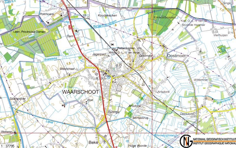
From close by to further away
Weststraat & Arisdonk
Surrounding municipalities & Ghent
East & West Flanders
Beyond the national borders
16th – early 18th century
In the 16th, 17th and up to the early 18th century we find a large concentration of Van Holderbeke families in the Weststraat and at Arisdonk.
Afterwards
Afterwards the families spread over the whole municipality, with a few larger clusters at the Hoekje, the Leest, the Jagerpad, Beke and the Kere.
The wider spread
While the Van Holderbeke families mostly stayed grouped in Waarschoot and the surrounding municipalities, the Meetjesland and Ghent until the middle of the 18th century, the further spread came first over East and West Flanders and then over the whole Flemish territory from the end of the 18th century; later followed the whole of Belgium, France, Canada and the USA in the 19th century, and Great Britain, the Netherlands and Germany from the 20th century.
We also have a few families in the Caribbean, Peru and Brazil
Description of the place by Roland Van Holderbeke · Pagina7.htm. The map and text are preserved archive material; the schematic route above summarises his description.
About the sourcesThe people behind the places